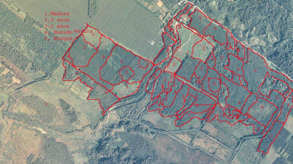


BARCA conducts land evaluation for the establishment of plantations through site selection and classification, correlation of reference data (soil-climate-growth of forest species), soil analyses, classification of vegetation types and special areas, and the definition of the criteria for establishment and planting, such as internal roads, infrastructure, drainage systems, etc.
Plantations are mapped through geographic information systems (GIS) in order to calculate specific areas (net plantable regions, buffer zones, etc.).
BARCA identifies potential environmental hazards and recommends actions to mitigate them with risk management systems for fire, flood, winds, storms and vandalism.
 Hacienda Doña Victoria, Palmar Sur, Puntarenas, Costa Rica
 (506) 8847-0521
